Posts

Showing posts from January, 2017

Fishponds in Kraśnicza Wola - International Bird Refuge

Image
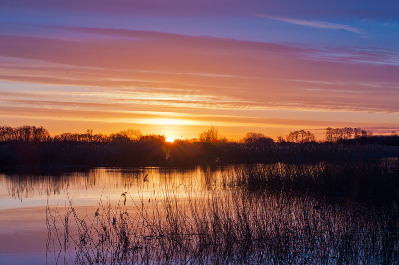
Fishponds in Kraśnicza Wola (Mazovia region, Poland) are the piece of the "Rozłogi" wilderness. Along with the surrounding areas of agricultural and forest are part of an international bird refuge (IBA) with an area of about 1300 ha. Ponds were created in the 30s of the 19th century. The last time the fish were bred here in 1995, since then not carried out maintenance of ponds, water structures underwent devastation, some heavily overgrown ponds and shows a high degree of naturalness. Abandoning fish breeding was due to regular water shortages during the summer months and the escalating of poaching. Despite the small area, the fishponds are an important place for birds and amphibians. If you keep silence, you can hear birds In their natural environment, herds of geese and cranes (e.g. white-fronted goose, bean goose and the golden plover). The total concentration of wetland birds during the time of migration of birds date back to 20000. Wilderness "Rozł

Externsteine - magical rock formation, Germany

Image
During travelling through the scenic Teutoburg Forest in the German state of North Rhine-Westphalianear, you can find the picturesque group of rocks a few kilometres from the town of Horn-Bad Meinberg. Its name - Extersteine - usually translates as stones of the ridge. This is a highly unusual rock formation. In an area otherwise devoid of large rocks, the soaring, slender columns of Externsteine stand out as they rise sharply and with no little majesty from the surrounding landscape. The 13 sandstone pillars have been ornamented over the millennia by human hand. Yet the true origins of the star stones can be discovered through geology. The unusual geological formation consists of a hard, erosion-resistant sandstone (so-called Osningsandstein), laid down during the early Cretaceous era about 100 million years ago. Thousands of years of erosion have washed the rocks from the surrounding soil and then were formed the surface of the stone. The rock formation stretches for seve

Holy Mount of Grabarka, Poland

Image
The Holy Mount of Grabarka (Święta Góra Grabarka in Polish), eastern Poland,  also known as the Mountain of Crosses, is considered to be the holiest location in the country Orthodox Christians. It is the site of the Church of the Transfiguration of the Lord and is home to the women's monastery of Ss. Marta and Maria. It is the traditional pilgrimage centre for Orthodox Christians. They arrive in large numbers especially on the 19th of August, the day of Transfiguration of Jesus. The most prominent and well-known feature of Grabarka is the forest of crosses surrounding the Orthodox church, all brought to the Mount by pilgrims. Pilgrims have been bringing votive crosses to the hill ever since. They come in different forms and sizes, from small ones made of sticks, through bigger wooden crosses to few concrete ones. Some of them are already rotten, some brand new, often with epitaphs engraved in Cyrillic alphabet. All of them, however, were brought for personal intenti

Brasov's Medieval Defensive Fortifications

Image
Old Town of Brașov and the White Tower. A view from Tâmpa Hill Brașov is located in the central part of Romania in Transylvania region. The oldest traces of human activity and settlements in Brașov date back to the Neolithic age but the first attested mention of Brașov is Terra Saxonum de Barasu ("Saxon Land of Baras") in a 1252 document. The city was described under the name Corona, a Latin word meaning "crown", a name given by the German colonists. Old Town of Brașov. White and Black Towers and Brașov Fortress (on the hills over the city) The German name Kronstadt means "Crown City" and is reflected in the city's coat of arms as well as in its Medieval Latin name, Corona. The two names of the city, Kronstadt and Corona, were used simultaneously in the Middle Ages, along with the Medieval Latin Brassovia. Probably the name of Braşov (Brassovia) came from the name of the local river named Bârsa. Dupa Ziduri Street (En. Behind the Wall

Esztergom - the cradle of Hungarian statehood

Image
The small town of Esztergom sitting on the Danube bank in Hungary played an important role in the establishment of the Hungarian state. Esztergom is one of the oldest towns in Hungary.  As a royal seat for two centuries and as a centre for the Roman Catholic religion for 1000 years it abounds Esztergom historic and cultural sights. The symbol of Esztergom is the impressive basilica. Primatial Basilica of the Blessed Virgin Mary Assumed Into Heaven and St Adalbert is the largest church in Hungary. The building has imposing sizes: height of 100 m, and the inner diameter of the cupola - 33,5 m. The building of the present church took place on the foundation of several earlier churches which were built in this place from 10th to 19th centuries. The Basilica was built according to the plans of Pál Kühnel, János Páckh and József Hild. The foundation stone was laid in 1822 and the building of the Basilica took 47 years. During the construction of the Basilica, builders dug down as f
Related Posts Plugin for WordPress, Blogger...

Most Recent Articles

See Also